Camping is allowed at both Emerald and Pear Lake. My companion George had a difficult time adjusting to the high altitude and the 2000 ft elevation climb. We decided to stop and camp at Emerald Lake, about 1.5 miles short of our planned destination at Pear Lake. We were able to get a great site, isolated from the rest of the campground and close to the lake. The lake was clear and there were many trouts jumping on the surface of the lake. The following day we hiked over to Pear and climbed the surrounding mountain cliff. My son, Justin, took a shortcut by climbing directly up the mountain face that separated two lakes. This was in late August and snow could still be seen on the upper mountain range. On the hike out, we could hear a large pack of coyotes barking and howling as we left.
By clicking on them you will bring up a larger JPEG view of them.
- Wolverton - Backpacks: We gotta carry all of this - How Far??? - Your crazy?d&&##
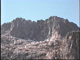
- The Watchtower - A large 8000 ft slab raising from the valley floor
- The Watchtower - A closer view of the top of the granite slab


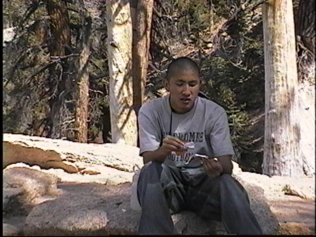
- Justin - Taking a break at the Watchtower vista
- The Watchtower - View East toward the tableland. We will be hiking on the right side of the canyon wall
- The Watchtower - View straight down; the shadow on the left is the Watchtower vertical surface


- Watchtower Trail - On the trail, The trail is dynamited out the side of the canyon wall
- Breakfast - first night out in the wilderness- Boy! That first cup of coffee taste good
- Emerald Lake - The lake is located in a horseshoe granite bowl at the base of Alta Peak


- Emerald Lake - Reflection of the mountain top off the surface of the lake
- Alta Peak - The second highest point in Sequoia NP. The peak raises 2500 ft above the lake. We will attempt to scale it in the morning from Pear Lake
- Solar Outhouse - These solar power outhouses were located at both Emerald and Pear Lake. Absolutely the cleanest!!!


- Pear Lake - Pear is located directly west of Emerald Lake approximately a 1/2 mile away as the crow flys.
- Pear Lake - Slightly larger than Emerald with some trees on the shoreline.
- Alta Peak - Alta Peak as seen from Pear Lake. This is mid-August and you can still see snow at the top!!


- Pear Lake - The east cliff face, the start of the climb to the top
- Up the Cliff - is finding it a tough go!!!
- Pear Lake Overlook - Scaling the mountain range surrounding Pear


- Granite Face - Outcropping overlooking Pear Lake
- Pear Lake - South end of the lake at the base of Alta Peak which raises 3000 ft above
- Pear Lake - West Side; Justin cross over from Emerald through this gap. A dangerous climb down on loose and slippery rocks


- Emerald Lake - Time to take a break after the hard climb, back at our base camp at Emerald
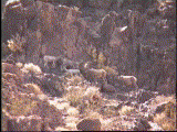
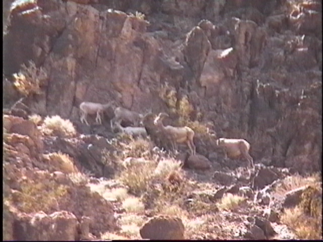
- Wild Rams - He's about a 1/2 mile up the canyon wall
- The Herd - Lots of them hidden in the canyon wall
- The Watchtower - View straight down; the shadow on the left is the Watchtower vertical surface


